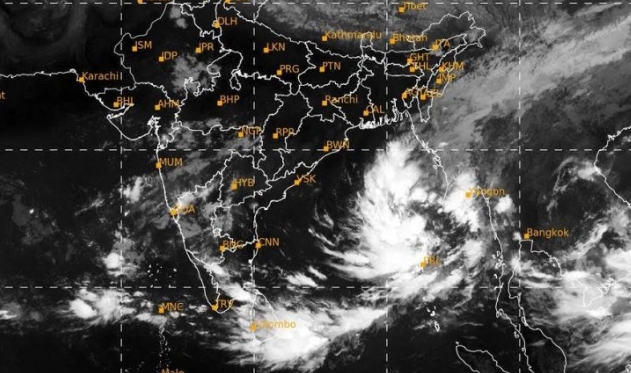
Odisha, WB coasts brace for cyclone as low pressure strengthens into depression

.Bhubaneswar: The well-marked low-pressure area over the Bay of Bengal intensified into a depression Tuesday morning as it rolled towards the eastern coast with the likelihood of turning into a severe cyclonic storm, the IMD said.
In its bulletin, the India Meteorological Department (IMD) said that the well-marked low-pressure area over the east-central Bay of Bengal moved west-northwestwards, concentrated into a depression and lay centred at 730 km southeast of Paradip in Odisha around 5.30 am.
“It is very likely to move west-northwestwards and intensify into a cyclonic storm by October 23, 2024, over east-central Bay of Bengal,” the bulletin said.
Thereafter, the weather system will continue moving northwestwards and is very likely to intensify into a severe cyclonic storm, which will cross north Odisha and West Bengal coasts between Puri and Sagar Island on the night of October 24 and morning October 25 with a wind speed of 100-110 kmph gusting 120 kmph, it added
The system is likely to affect the coast of both Odisha and West Bengal with heavy rain and high-speed wind, the bulletin said.
Advising fishermen not to venture into the sea from October 23 to 25, the IMD warned that wind speed is likely to reach 60 kilometre per hour (kmph) along and off Odisha-West Bengal coasts and gradually increase thereafter.
A deep depression is a more intense stage of a low-pressure system and typically precedes the formation of a cyclonic storm, according to the IMD.
The Odisha government has cancelled the leaves of all staff from October 23 to 25 in view of the cyclone forecast.
In a letter to all the departments, Special Relief Commissioner (SRC) DK Singh has asked them to remain prepared to tackle the challenges of the impending calamity.


